Teluk Intan (Teluk Intan)
 |
In the early days, the town was known as Teluk Mak Intan, after a female Mandailing trader. It was here that the Perak rulers held court from 1528 until Kuala Kangsar became the royal town in 1877.
During the British protectorate era, the named was changed to Teluk Anson (Anson Bay), in honour of a British officer and last lieutenant-governor of Penang, Major-General Sir Archibald Edward Harbord Anson, who drew the plan of the modern township in 1882.
In 1982 during the centenary of the town's establishment, the name was changed again to Teluk Intan (Diamond Bay) by the Sultan of Perak. Leaning Tower of Teluk Intan is one of the town attractions. The town has a number of colonial buildings and Chinese shophouses together with modern buildings, few shopping complexes and a modern cinema.
The town was founded on the river bank of the Perak River. The river forms an oxbow meander as it flows through the town, and the town is built around the oxbow. During high-tides, some parts of the town will be flooded with water even though there are watergates and banks to protect the town. Various measures taken by the government to solve the problem have seen relatively few floods in Teluk Intan nowadays. There has been speculation that the river's flow will erode the narrow neck of land in between the loops of the meander effectively turning Teluk Intan into an island.
The town is on Malaysia Federal Route 58 (Jalan Changkat Jong and Jalan Maharaja Lela), Perak State Route A151 (Jalan Sultan Abdullah) and Perak State Route A147 (Jalan Padang Tembak).
Map - Teluk Intan (Teluk Intan)
Map
Country - Malaysia
 |
 |
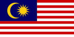
| Flag of Malaysia | |
Malaysia has its origins in the Malay kingdoms, which, from the 18th century on, became subject to the British Empire, along with the British Straits Settlements protectorate. Peninsular Malaysia was unified as the Malayan Union in 1946. Malaya was restructured as the Federation of Malaya in 1948 and achieved independence on 31 August 1957. The independent Malaya united with the then British crown colonies of North Borneo, Sarawak, and Singapore on 16 September 1963 to become Malaysia. In August 1965, Singapore was expelled from the federation and became a separate independent country.
Currency / Language
| ISO | Currency | Symbol | Significant figures |
|---|---|---|---|
| MYR | Malaysian ringgit | RM | 2 |
| ISO | Language |
|---|---|
| ZH | Chinese language |
| EN | English language |
| MS | Malay language |
| ML | Malayalam language |
| PA | Panjabi language |
| TA | Tamil language |
| TE | Telugu language |
| TH | Thai language |


